Phoenix
Phoenix (Phoenix /ˈ fiːn ɪ k s); translated by Phoenix, Oodham: S-ki: kigk; jawapai: Wathinka or Wakatehe; sp-ap: Fiinigis; navajo: Hoozdoh; mohave: 'Anya Nyava) is the administrative center and the largest city in the American state of Arizona. With a population of 1,660,272 (2018), Phoenix is the largest administrative center of all in the United States, including Washington's federal capital, and the country's 5th largest city (after New York, Los Angeles, Chicago, and Houston).
| City | |||
| Phoenix | |||
|---|---|---|---|
| Phoenix | |||
| | |||
| |||
| 33°27'00″ pp. 112°04'00″ h.d. | |||
| Country | USA | ||
| Status | state administrative center | ||
| State | Arizona | ||
| District | Marikopa | ||
| Mayor | Kate Galego (E) | ||
| History and geography | |||
| Founded | 4 May 1868 | ||
| First Mention | 1867 | ||
| City with | 25 February 1881 | ||
| Area | 1,343.94 km² | ||
| Center Height | 331 m | ||
| Climate Type | arid | ||
| Time zone | UTC-7:00 | ||
| Population | |||
| Population | 1,660,272 people (2018) | ||
| Density | 1238.37 persons/km² | ||
| Katoikonim | Phoenix, Phoenix | ||
| Official language | English | ||
| Digital IDs | |||
| Phone code | 480, 602, 623 | ||
| Zip Code | 99 ZIP codes: 85001—85099 | ||
| FIPS Code | 04-55000 | ||
| Other | |||
| Names | Solar Valley, Valley | ||
| phoenix.gov (English) | |||
| Media files on Wikimedia Commons | |||
Phoenix is the center of the district of Marikopa and one of the largest cities in the United States in the area occupied.
Phoenix Agglomeration (also known as the Solar Valley is part of the Salt River Valley) with a population of 4,857,962 (2018) is the 11th in the US.
Population growth in Phoenix agglomeration over the past 40 years averages 24% per decade. Although Phoenix's population has been shrinking, it has been recovering since 2008, when the 2008 sub-prime mortgage crisis and falling house prices started to bring more immigrants to the city, mostly from Mexico. Judging by the current growth rate, analysts predict that Phoenix could become the 4th largest city in the US by 2020.
History
For more than 1,000 years, the land on the site of modern Phoenix was owned by the Hochoc tribes, which created for irrigation of these desert areas approximately 217 km of irrigation canals, some of which are still used for their intended purpose. At the turn of the XVI-XVII centuries, the civilization of the Hochocamas died out, having failed to withstand the dried-up climate. The Spanish settlement called Phoenix meant the re-creation of the dying hokokam civilization from the ashes of life. Spanish researcher Eusebio Cino was one of the first Europeans to study the area in the 17th and 18th centuries. After the end of the 1848 US-Mexico war, most of the land in northern Mexico fell under US control, with parts of it then created New Mexico (which included the land of today's Phoenix). During the Civil War the region of Phoenix was challenged by two administrations of the territory of Arizona — Confederate (with capital in Tuson) and Allied (with capital in Prescott). In 1865, after the end of the war, the American army founded Fort McDowell here to stop Indian raids on settlers.
The foundation of Phoenix itself is connected with the name of the veteran of the Confederate Army Jack Swiling, in 1867 founded a farm at the foot of the White Tank Mountains mountains on the ruins of the old Indian settlement. The city was growing rapidly, and on May 4, 1868 there was a post office (which, at that time, actually meant the status of the city), with Sville as a postmaster.
Phoenix before the beginning of the 20th century.
In the 1870s the city began to grow, therefore on April 10, 1874 President Ulysse S. Grant awarded Phoenix a land patent. In 1875 there was a telegraph, 16 salons and 4 dance halls. By 1880, the population of the town had grown to 2453.
In 1881 Phoenix continued to grow, and the Arizona Territory Legislatura published on February 25 the Treaty Bill of Phoenix, according to which Phoenix officially became a city.
The first revolutionary event for the Finnish economy was the construction of a new railway in the 1880s, passing through the new city. Thanks to this, Phoenix began to develop as a trading city, and its products began to be sold in both the eastern and western markets. This opened the Phoenix Chamber of Commerce on November 4, 1888. Earlier in the same year, the then city services moved to a new town hall. When in 1889 the territorial capital was moved from Prescott to Phoenix, the temporary territorial services also began to be in the town hall. In 1895, the Santa Fe, Prescott and Phoenix railway was opened, connecting Phoenix with many other cities, which gave the city another boost in the economy. In addition, in 1895 the first high school in the city was foundedwhich included 90 students.
In 1906, the construction of the so-called No. 1 Dam on the Salt River began on the Salt River, 75 km from the city, which became the first multifunctional dam as it was planned to supply water and electricity to the city. On May 18, 1911, the opening of the dam was attended by President Theodor Roosevelt, who signed a decree in 1902 to build huge dams on the rivers of the western territories. At that time, the structure was the largest stone dam in the world. In 1959 and the reservoir was renamed in honor of the president who built it.
On February 14, 1912, under President William Howard Tafte, Phoenix became the capital of the newly established state of Arizona. This happened six months after Taft vetoed Congress's vote to grant Arizona state status because of his opposition to Arizona's position on the recall of the judges. After Arisona's acquisition of state status, Phoenix began to grow rapidly, and after eight years the city's population was 29,053. In 1920 in Phoenix appeared the first skyscraper, Heard. In 1929, the Heavenly Bay was officially opened, at that time owned by Scenic airline. In 1935, the airport was acquired by the municipality of Phoenix, in whose possession it is now. In a decade, the population of Phoenix doubled to 48,118.
During World War II, rapid economic development quickly transformed Phoenix from a regional trade center into a city with an emerging industry based on mass production of military products. In addition, three military air bases (Luke, Williams and Falcon) were built in the suburbs at the same time, as were two Thunderbird pilot schools (in Glendale and Scottsdale).
After the war, Phoenix, a city with a population of more than 65,000, continued to grow rapidly, owing in part to the emergence of young and ambitious entrepreneurs and politicians (such as Barry Golduoter), most often with Eastern education, who subsequently created a special neoliberal Phoenix's business atmosphere.
In 1948, high-tech production, which became the basis of the state economy, began to develop in Phoenix when Motorola chose this city to build its own Center for Research and Development for Military Electronics. Realizing Motorola's choice, other high-tech companies, such as Intel and McDonnell Douglas, have opened up their production areas in the Valley.
In 1950, more than 105,000 lived in Phoenix, and more in the surrounding area. In the 1950s, the city's growth was stimulated by the development of ventilation equipment, which became widely used (in homes, offices and manufacturing facilities), making it possible to live in the city during the long summer of Phoenix, known for extreme heat.
In 1959 alone, more buildings were built in Phoenix than in the three-year period from 1914 to 1946.
In the following decades, the city's growth and agglomeration continued, and the tourist flow to the city increased, mainly due to the unusual location of the city in the desert and the good opportunities for recreation. In 1965 the Finicksov Corporate Center opened, the highest building in Arizona (104 m). In the 1960s, other buildings were built in a rapidly growing city, such as: Rosenweig Center (1964), now known as Phoenix City Square, Phoenix Financial Center (1968) and many residential complexes. In 1965, the Colosseum was opened to the west of Downtown, one of Arizona's largest sports arenas. Also in 1968, President Lyndon Johnson adopted the Central Arizona project, which is designed to maintain water reserves for Phoenix, Tucson and the agricultural spaces between them. On December 2, 1969 Pope Paul VI created the Diocese of Phoenix, separating it from the Archdiocese of Tucson. Edward McCarthy became the first bishop of Phoenix.
The 1970s were the peak of activity in building new buildings in Downtown Phoenix. At the end of the decade, the city's authorities adopted the Phoenix 2000 concept, according to which it was planned to divide Phoenix into several urban settlements, each with its own nucleus, in which the population density is significantly higher than on the outskirts. Originally planned to make 9 settlements, but over the years their number increased to 15. The authorities implemented the concept by creating transport hubs in the settlements and connecting them with highways. In the 1970s, several remarkable buildings were opened in Downtown: Phoenix Symphony Theater, Wells Fargo Plaza, Chase Tower (formerly Valley Center, 147 m, highest Arizona building), U.S. Bank Center.
Thanks to the recommendation of President Reagan, on September 25, 1981, Finic Sandra O'Connor became the first female judge in the Supreme Court of the United States. In 1985, the Palo Verde Nuclear Power Plant, the largest nuclear power plant in the country, was opened. In 1987 John Paul II and Mother Teresa came to the city.
The result of the influx of emigrants in the 1990s who settled in Sunnislow's state-owned homes In 2000, local schools were able to speak 43 languages. In 1992 a new building of the Town Hall was builtand in 1993, at the initiative of Sheriff Joe Arpayo, came the "Tent Town", built by prisoners to relieve the overcrowded prison system of the Marikop District (the world's 4th largest). In March 1997 there was a known phenomenon of Phoenix fire.
Phoenix's population continues to grow, with a population growth of 24.2% since 2007, making Phoenix the second fastest growing in the US after the Las Vegas agglomeration. In 2008, Skvo Peak was renamed to Peyestevy Peak in honor of Laurie Payestevathe Arizona and the first Indian woman to die in combat, as well as the first American to die during the Iraq War in 2003. In 2008, Phoenix was one of the most affected cities in the US by the mortgage crisis. In early 2009, the average price of a house in the city was $150,000, down from a record $262,000 in 2007. The crime rate in Phoenix has also declined significantly in recent years, as some previously dangerous, decaying areas such as South Phoenix, Alhambra and Maryville (now West Phoenix) have been rebuilt and the situation in them has been restored stabilized. Downtown and Central Core were recently upgraded, and many restaurants, shops, and businesses opened or moved to Central Phoenix.
Geography
Geographic Location
Phoenix is located in the south central part of Arizona, one of the southwestern states of the United States, halfway between Tucson and Flagstaff. Phoenix is located in the Solt Valley, also known as the Solar Valley, at an altitude of 340 m from sea level, in the central part of Arizona, in the heart of the Sonora desert.
Although the city is surrounded by mountains from all sides, Phoenix is located on a large plain, thanks to which a clear network of city streets and roads was created. In the valley around the city there are different mountain ranges: McDowell in the northeast, White Tank in the west, Superstishn in the east, and Sierra Eastrella in the southwest. On the outskirts of Phoenix there are huge irrigated fields and several Indian reserves. The Salt River (the Solar River) crosses the city from east to west. The river bed is almost always dry, except for the release of water from the reservoir, which was created for the uninterrupted supply of fresh water and irrigation to the city and is located upstream. The town of Auatuki is separated from the town by the park of the South Mountains.
According to the U.S. Census Bureau, the city is 1,343.94 km², of which 1,340.69 km² (99.8%) is land and 3.25 km² (0.2%) is water. Although the city is the 5th largest in the U.S., thanks to its vast territory, Phoenix has a relatively small population density (1,238.37 people/km²), with about 4,555 people in Philadelphia (the 6th largest) ./km².
As in most of Arizona, no daylight saving time has been observed since 1973 in Phoenix.
Neighbors
Since 1979 Phoenix is divided into urban settlements, many of which were historical neighborhoods in the city. Each settlement has a planning committee subordinate to the city council and obliged to monitor the development of its settlement and its nucleus, and to preserve a unique image that defines the settlement among others.
A total of 15 settlements were established:
- Alhambra
- East Kemelbek
- Desert View
- Dir Valley
- Paradise Valley
- Lavin
- Mareville
- North Gateway
- Podgorya Ahuatuki
- Rio Vista
- Northern Mountains
- Central city
- Encanto
- Estarla
- Southern Mountains
In addition to urban settlements, there are several neighborhoods in Phoenix: Downtown, Midtown, West Phoenix, North Phoenix, South Phoenix, Biltmore, Arcadia and Sunnislop.
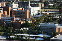
City panorama
Climate
Phoenix's climate is arid (in Köppen's BWh), typical of dry and hot deserts like Sonora. In terms of thermal conditions, it resembles the climate of cities in the Gulf region of Baghdad or Riyadh (but the annual distribution of cloud and rainfall is very different).

Over 80 days a year, from the end of June to September, the average daily temperature exceeds +30 °C, and the daily temperature (average maximum) is about +39...+41 °C. The absolute maximum of +50 °C was registered on June 26, 1990, the absolute minimum on January 7, 1913 was -8.9 °C. The minimum winter temperature is very rarely below zero, most recently on January 2, 2019. Until then, temperatures were last below zero between 12 and 15 January 2013.
The number of clear days per year is about 330 (more than 90% of the year). The average annual precipitation is 190-210 mm (the average for a year is 50 days with precipitation), the most humid month is July (27 mm), the driest month is June (1 mm). There is one dry period in the year - April-June (with precipitation of 1-7 mm per month) and two wet - January-March and July-August (with precipitation of 23-27 mm per month). In July-August, rains (7-8 days a month) and thunderstorms (about 6 days a month) are most common compared to the rest of the year. The average annual number of days with a storm is 22, with a fog - 6 (fog occurs between December and February).
Snow in the city is very rare, it was celebrated only seven times, most recently in December 1985. The maximum snow cover height reached 10 cm in January 1937. Sometimes there are dusty storms.
Phoenix is the hottest and one of the driest cities in the United States. It is also one of the hottest cities in the world.
| Phoenix climate (norm 1981-2010) | |||||||||||||
|---|---|---|---|---|---|---|---|---|---|---|---|---|---|
| Indicator | Jan. | Feb. | March | Apr | May | June | July | Aug | Sep. | Oct. | Noyab. | Dec. | Year |
| Absolute maximum, °C | 31.1 | 33.3 | 37.8 | 40.6 | 45.6 | 50.0 | 49.4 | 47.2 | 46.7 | 41.7 | 35.6 | 30.6 | 50.0 |
| Average maximum, °C | 19.6 | 21.5 | 24.9 | 29.6 | 34.9 | 39.9 | 41.2 | 40.2 | 37.7 | 31.4 | 24.2 | 18.9 | 30.3 |
| Average temperature, °C | 13.6 | 15.4 | 18.4 | 22.6 | 27.8 | 32.7 | 34.9 | 34.2 | 31.3 | 24.8 | 17.8 | 13.0 | 23.9 |
| Medium minimum, °C | 7.6 | 9.3 | 11.9 | 15.7 | 20.8 | 25.4 | 28.6 | 28.2 | 24.9 | 18.2 | 11.5 | 7.1 | 17.4 |
| Absolute minimum, °C | -8.9 | -4.4 | -3.9 | 1.7 | 3.9 | 9.4 | 17.2 | 14.4 | 6.3 | 1.1 | -2.8 | -5.6 | -8.9 |
| Precipitation rate, mm | 17.0 | 17.3 | 22.4 | 5.6 | 3.0 | 3.3 | 21.1 | 24.4 | 21.8 | 16.5 | 16.8 | 25.4 | 194.6 |
| Source: Weather and climate,[1] | |||||||||||||
Population
| Population census | |||
|---|---|---|---|
| Census year | Us. | %± | |
| 1870 | 240 | — | |
| 1880 | 1708 | 611.7% | |
| 1890 | 3152 | 84.5% | |
| 1900 | 5544 | 75.9% | |
| 1910 | 11,314 | 104.1% | |
| 1920 | 29,053 | 156.8% | |
| 1930 | 48,118 | 65.6% | |
| 1940 | 65,414 | 35.9% | |
| 1950 | 106,818 | 63.3% | |
| 1960 | 439 170 | 311.1% | |
| 1970 | 581,562 | 32.4% | |
| 1980 | 789,704 | 35.8% | |
| 1990 | 983,403 | 24.5% | |
| 2000 | 1,321,045 | 34.3% | |
| 2010 | 1,445,632 | 9.4% | |
| Current 2018 | 1,660,272 | 14.8% | |
| 1870-2018 | |||
| Race composition of the population | 2010 | 1990 | 1970 | 1940 |
|---|---|---|---|---|
| White (including white Hispanic) | 65.9% | 81.7% | 93.3% | 92.3% |
| White without Hispanic | 46.5% | 71.8% | 81.3% | n/a |
| Latin Americans (all races) | 40.8% | 20.0% | 12.7% | n/a |
| African Americans | 6.5% | 5.2% | 4.8% | 6.5% |
| Asian Americans | 3.2% | 1.7% | 0.5% | 0.8% |
According to preliminary data for 2018, the city had 1,660,272 inhabitants, making Phoenix the fifth city in the United States and the first in the U.S. capitals.
After a decade of lifespan in the US cities in terms of population growth, Phoenix's pace declined markedly due to the mortgage crisis. For this reason, in 2009, the population of the Phoenix agglomeration increased by only 77,000, compared with the peak of 162,000 in 2006. In the decade since 2000, the population of Phoenix increased by 124,000 (9.4%), and the agglomeration population increased by 28.9% over this period.
The Phoenix agglomeration, officially known as the Phoenix Agglomeration, Mesa and Glendale, is one of 10 agglomerations in Arizona, the 11th largest population in the United States (4,85) 7 962). In the agglomeration there are 65.5% of the population of Arizona. The Phoenix is only 13% in the growth of agglomeration, compared to 33% in the last decade.
The population of Phoenix is equally divided between men and women (men - 50.2%). The average age of urban residents is 32.2 years, only 10.9% of the population - over 65 years. 98.5% of the Finnish population live in households with an average capacity of 2.77. The total number of households in the city is 514,806, 64.2% of which are families: 42.3% of married couples, 7% of single men headed the household and 14.9% of single women. In 33.6% of households there are children under 18. Of the 35.8% of non-family households, 27.1% have one person (women - 13.7%, men - 13.5%).
The average annual household income is $47,866, and the family income is $54,804. The average annual income of men is $32,820, of women - $27,466. 21.8% of the population and 17.1% of households are below the poverty line. 31.4% of them are under 18 and 10.5% - 65.
According to the census (2010), the people of Phoenix consider themselves among the following peoples and races:
- White: 65.9% (non-Spanish - 46.5%)
- Latin Americans (all races): 40.8%
- Mexicans - 35.9%
- Puerto Ricans 0.6%
- Guatemalans - 0.5%
- Salvadorans - 0.3%
- Cubans - 0.3 %
- African-Americans: 6.5% (non-Spanish 6.0%)
- Asian Americans: 3.2%
- Indians - 0.8%
- Filipinos - 0.5%
- Koreans - 0.5%
- Chinese - 0.4 %
- Vietnamese - 0.4 %
- Japanese - 0.2%
- Thais - 0.2%
- Burmese - 0.1 %
- Native Americans: 2.6%
- Hawaiians and Other Islanders: 0.1 %
- Other races: 0.1 %
- Multiracial Americans: 1.7%
Of the 1,660,272 citizens over 5 years of age, 63.5% use only English in their home, 30.6% use Spanish, 2.5% use other Indo-European languages, 2.1% use Asian or island languages, 1.4% speak other languages. 15.7% of non-English speakers know it worse than "very well."
35.9% of the city's residents identify themselves as Mexicans, 15.3% as Germans, 10.3% as Irish, 9.4% as British, 6.5% as Africans, 4.5% as Italians, 2.7% to French, 2.5% to Poles, 2.2% to Indians and 2.0% to Scots.
According to the 2010 religious census, 39% of respondents identified themselves as belonging to a religious group: 35% of them are Catholics, 22% are Evangelists, 16% are Mormons, 14% are non-denominational Christians, 7% are ordinary Protestants, 2% are Hindus, and the remaining 4% are other religions (particularly Buddhism and Judaism) and atheists.
Economics
At the beginning of its development, Phoenix's economy was based on agriculture and natural resources. "5C" copper, cattle, climate, cotton and citrus, i.e. copper, cattle, climate, cotton and citrus). Only after the completion of the Salt River project did the city begin to develop intensively, thanks to the newly restored water reserves. Agriculture has been modernized from alfalfa to cotton, citrus and other crops. By the mid-1910s, nearly 0.25 acres of arable land were cultivated.
When World War I started, American production stopped receiving imported cotton, which was used in the manufacture of tires and coatings for aircraft, so the industrialists began to look for new sources of this material. The valley of the Salt River is an ideal place for them. Manufacturers (such as Goodyear) have started buying more and more cotton from Phoenix. By that time, the company had founded Goodyear, south-west of Phoenix, to grow cotton on its own. By 1918, cotton shifted alfalfa from the first place of cultivation in Phoenix. By 1920, when cotton was cultivated by 75% of the area, demand for it began to decline, owing to the end of the war, the absence of the need to build new military vehicles, and the return of foreign producers to the US market. For these reasons, it was decided to reduce the cotton areas around Phoenix.
Cattle, like the meat industry associated with it, was also an important part of the city's economy. After the decline in cotton production, the area sown in Marikop was given to alfalfa, wheat and barley, as well as to new citrus plantations. After that, the development of the cattle-breeding industry began. In the late Revolving Twenties, Phoenix was the largest meat producer between Los Angeles and Dallas.
Flour began to flourish after a brief depression in Phoenix thanks to the change of cotton from other crops. First high-rise building, 7-story Heard, was built in 1920, in 1924 the following, 10-story Luhrs, in 1928 appeared a building in 16 floors, Hotel Westward.
With the establishment of the South Pacific Railway in 1926, the opening of the train station in 1923 and the establishment of the airport at the end of the decade, it became much easier to get into the city. In the 1920s, hotels and resorts were built together by the municipality and entrepreneurs: Westward Ho, Ingleside Inn, Jokake Inn, San Carlos, and Arizona Biltmore, created by one of Frank Lloyd Wright's students and built in 1929. By the end of the decade, for the first time in the history of the city, Phoenix's income from tourism had exceeded $10 million. Since then, tourism has become one of the driving forces of the Phoenix economy.
The Great Depression affected Phoenix, but not as much as the country's other cities, because Phoenix already had a well-structured strong economy, and the city was spending less on the productive sector than other cities, so, despite the bankruptcy and unemployment, by 19 34 the city was completely restored .
After World War II, the population of Phoenix began to recover and continued to grow. In 1948 Motorola chose Phoenix as a place to build a scientific center for the development of military electronics. The city's growth made the real estate industry dawn, with the city of Sun City being erected from scratch to the northwest of Phoenix by 1960.
When the financial crisis took place in 2007-2010, construction in Phoenix was halted, and property prices plummeted. Because the real estate market plays an important role in the city's economy, Phoenix became one of the first cities in the US to experience the last recession.
Phoenix hosts the headquarters of Fortune 500 corporations, such as Avnet (electronics), Freeport-McMoRan (mining), PetSmart (animal goods), Republic Services. Intel owns seven factories in Phoenix with a total staff of over 12,000, and has spent $5 billion to expand its factories. There is also the main information processing center of American Express. In addition, in Phoenix are located the headquarters of U-Haul, one of the largest U.S. mouvings companies, Best Western, the largest hotel chain in the world, Apollo Groupof the University of Phoenix. US Airways, part of American Airlines, has corporate headquarters in Phoenix and is the main airline at Sky Harbor Airport.
Due to the status of the state capital, the public sector (public administration at various levels and educational and health institutions) plays a significant role in the city economy. However, unlike most state capitals, the public sector is not dominant in the Phoenix economy.
In Phoenix there are consulates of 30 States and 11 foreign chambers of commerce and trade representations.
Sports
| Club | Sports | League | Stadium | Founding Year | Victories |
|---|---|---|---|---|---|
| Arizona Cardinals | American football | National Football League - NFC | Phoenix University Stadium | 1898 | 2 |
| Arizona Diamondbacks | Baseball | Baseball League Home - UL | Chase-field | 1998 | 3 |
| Phoenix Sunz | Basketball | National Basketball Association - Western Conference | US Airway Center | 1968 | 0 |
| Arizona Koyotis | Hockey | National Hockey League - Western Conference | Jobing.com Arena | 1972 | 0 |
| Phoenix Mercury | Women's basketball | Women's National Basketball Association - Western Conference | US Airway Center | 1997 | 2 |
| Arizona Rattlers | Indoor American football | American Football League indoors — West Division AFL | US Airway Center | 1992 | 3 |
| FC Phoenix Rising | Football | U.S. Football Federation - Professional Division | Peoria sports complex | 2014 | 0 |
From 1989 to 1991, the U.S. Grand Prix took place on the Phoenix city road, Formula 1, canceled due to lack of popularity among spectators and transferred to 2000 on the Indianapolis Motor Speedway.
Management
on the left — the Senate,
right - House of Representatives,
in the background — the Tower of Executive Power
Crime
|
|
Education
Public education in Phoenix is represented by 29 school districts: 21 districts of primary schools (215 schools), 4 districts of high schools (31 schools), 3 of which are only partially represented in Phoenix (United Districts of Glendale), Tempe and Tolleson), and 4 single districts (58 primary and 4 high schools), which are taught under a full, twelve-year (K-12) program, only one of them, a single district of Paradise Valley it's all in Phoenix.
Phoenix High School District it is the country's largest school district, with 16 schools with about 3,000 employees and more than 27,000 students, covering about 600 km².
In addition, there are 30 charter schools in Phoenix.
Higher education
Arizona State University (USA) is Arizona's main institute. It consists of four campuses located at Tempa, West Phoenix, Polytechnic and Downtown Phoenix. USHA is one of the largest universities in the U.S. with 72,250 students (2011).
Phoenix also hosts a small campus of the University of North Arizona (bizarre in Flagstaffe).
District of colleges of the district of Marikopa consists of ten public colleges and two skill schools. Phoenix College, founded in 1920, is the oldest college in Arizona and one of the oldest in the country.
The city has countless universities:
- Barrow Neurology Institute — the world's largest scientific center for the treatment and research of neurological diseases.
- Grand Canyon University - private Christian University. Founded as a non-profit school in 1949, it was redeemed by investors, so it is now a fee-paying institution. The university has more than 31,000 undergraduates with bachelor's, master's, or doctorate degrees.
- Arizona Christian University — a non-profit evangelical institute located in the northern part of Phoenix.
- Thunderbird Management School — Private Business School, the main campus which is located in Glendale. The world's first business school to teach international entrepreneurship.
- Phoenix University is the country's largest commercial institute with 300,000 students on campus in the United States (including Puerto Rico), Canada, Mexico, and the Netherlands.
- Arizona Law School — a private institute located in Downtown Phoenix.
Media
Phoenix's first newspaper was the weekly Salt River Valley Herald, founded in 1878, which changed its name to Phoenix Herald a few years later. Later, the newspaper changed its name several times and eventually came to the present with the name Phoenix Herald, being online.
Today, the city is home to two of the largest daily newspapers: The Arizona Republic (azcentral.com), released for agglomeration, and East Valley Tribune, primarily produced for cities in the Eastern Valley. Jewish News of Greater Phoenix — Jewish independent weekly newspaper published since 1948. In addition, several free newspapers are published in the city, such as Phoenix New Times and published at the University of Arizona State Press.
The Phoenix agglomeration hosts many local TV stations, many of which are affiliated with national TV companies. More than 1.8m homes (1.6% of the country's total) are connected to television, making the agglomeration the largest in the South-West of the United States and the 12th in the country.
| Television stations in Phoenix | |||
|---|---|---|---|
| TV channel | Title | TV network | |
| 3 | KTVK | 3TV | N |
| 5 | KPHO-TV | CBS | |
| 7 | KAZT-TV | AZ-TV | N |
| 8 | KAET | PBS | |
| 10 | KSAZ-TV | Fox | |
| 12 | KPNX | NBC | |
| 15 | KNXV-TV | ABC | |
| 21 | KPAZ-TV | Trinity Broadcasting Network | r |
| 33 | KTVW-DT | Univision | and |
| 39 | KTAZ | Telemundo | and |
| 45 | KUTP | MyNetworkTV | |
| 48 | KDPH-LP | Daystar | r |
| 51 | KPPX-TV | ION Television | N |
| 61 | KASW | The CW | |
Infrastructure
Transport
Air
The city is serviced by the international airport Phoenix Sky Harbor (IATA: PHX, ICAO: KPHX), located 5 kilometers south-east of the business center. In 2011, the airport's passenger turnover amounted to 20.2 million people (the 10th place in the USA). Sky Harbor has more than 1,000 flights daily serving more than 110,000 passengers. Regular, non-stop passenger flights are operated by Aeroméxico, Air Canada, British Airways, and WestJet in 100 cities in the United States, Canada, Costa Rica and Mexico, as well as London and several Caribbean islands.
Phoenix-Mesa Airport (IATA: IWA, ICAO: KIWA), located in Mesa, shares with Skye Harbor the passenger airflow. It was discovered at the site of Williams Air Force Base, which was closed in 1993. Companies such as Allegiant Air, Frontier Airlines and Spirit Air fly to various U.S. cities.
Railway and Bus
There has been no passenger rail service in Phoenix since 1996. The nearest operating station is 48 kilometers south in Marikope, where the Sunset Limited (Los Angeles-New Orleans) and Texas Eagle (Los Angeles-San Antonio-Chicago) trains run by the Union Pacific Rail Company road (UP).
Even though the UP retained all the routes leading to the Phoenix station, Amtrak did not launch the train to the city, making Phoenix the most populated city in the United States without a train service.
Amtrak Thruway connects Skye Harbor airport to Flagstaff, which runs the Southwest Chief (Chicago-Los Angeles) train. In addition, in Phoenix (on 24th Street, near the airport) there is a bus station of the company Grayhound.
Public
Company Valley Metro owns a transportation system in the agglomeration, which includes LRT trains, buses and a car-sharing program. 3.38% of workers use public transport daily. This number decreases in the summer due to the fact that it is difficult to expect a bus in this heat at open stops.
On December 27, 2008, the first line (32 km) of the Finnish LRT, named METRO, was opened from the northern part of the city through Downtown to the east (through Tempe and Mesu). Valley Metro has plans to build 48 km of new lines by 2030
Bike
Bikes are one of the most popular modes of transport in the Marikopa district, and the district government has organized a number of comfortable bicycle routes and routes, so according to Bicycling Magazine, Phoenix is the 15th most suitable for cyclists in cities with a population of more than 100,00000000000000000000000000000000000000000000000000000000000000000000000.0000
Car
Phoenix's traffic depends on the state of the streets and the highway. The city's Phoenix Highways are the best and the state's bridges the best in the country. Although Phoenix is the sixth largest city in the United States, there are no congestion or other problems on the city's roads, as in other big cities. None of the city's highways are among the country's 100 worst.
In 2005, the agglomeration had more than 2,500 km of highway, making Phoenix one of the cities with the largest and fastest growing highway system.
The Phoenix street system and some suburbs are based on a lattice pattern, with most north-south or west-east routes, and the reference point is the Central Avenue and Washington Street intersection. According to the original plan, the horizontal streets were named after the presidents, and the vertical streets named after the Indian tribes, but soon the names of the vertical streets were replaced with numbers: avenue west of Central and streets east. The main streets are divided into sections of a mile (1.6 km), in which there are ≈ 1/8 mile (200 m) neighborhoods, such as Scottsdale Road, 7,200 is 9 miles (14.4 km) East of Central Avenue (72 / 8).
Phoenix Highway:
|
|
|
Twin cities
Phoenix has 10 sister cities defined by the city commission of the spawned cities:
| City | Original name | Province | Country | Year | |
|---|---|---|---|---|---|
| Grenoble | Fr. Grenoble | Auvergne - Ron - Alps | France | 1990 | |
| Calgary | English Calgary | Alberta | Canada | 1997 | |
| Catania | ital. Catania | Sicily | Italy | 2001 | |
| Prague | Czech Republic. Praha | Prague Capital District | Czech Republic | 2013 | |
| Ramat Gan | Hebrew רמת גן. | Tel Aviv District | Israel | 2005 | |
| Taibei | management kit 臺北, pignin Táiběi | Xinyi | Taiwan | 1979 | |
| Chengdu | management kit 成都, pinyin Chéngdū | Sichuan | China | 1987 | |
| Himedzi | jap. 姫路市 | Hyogo | Japan | 1976 | |
| Ennis | English Ennis eagle Inis | Claire | Ireland | 1988 | |
| Hermosillo | using Hermosillo | Sonora | Mexico | 1976 |
Notes
- ↑ American FactFinder (unreachable link). US Census Bureau. Case date: June 18, 2014. Archived February 1, 2012.
- ↑ When calculating population density, only the land area of the city was 1340.69 km².
- ↑ United States of America // Atlas of the World / Composition and Prepared for Publishing. PCO "Cartography" in 2009 ; rev D. V. Pozdniak. — M. : PCO "Cartography" : Onics, 2010. P. 168—169. — ISBN 978-5-85120-295-7 (Cartography). — ISBN 978- 5-488-02609-4 (Onics).
- ↑ Phoenix // Dictionary of geographical names of foreign countries / Rev. A. M. Komkov. — 3rd edition, overwork and additional — M. : Nedra, 1986. P. 392.
- ↑ Munro, P et al. A Mojave Dictionary Los Angeles: UCLA, 1992
- ↑ Phoenix QuickFacts from US Census Bureau (not available link). US Census Bureau. Case date: September 11, 2012. Archived June 10, 2012.
- ↑ County and City Data Book: 2007. US Census Bureau (2007). Archived March 20, 2016.
- ↑ Census: Phoenix-area population tops 4.3 million, moves up metro rankings — Phoenix Business Journal. Bizjournals.com
- ↑ People in Phoenix-Mesa-Scottsdale Metro Area, Arizona. Bestplaces.net
- ↑ Why Phoenix?. Growth Nation. Case date: February 17, 2014.
- ↑ 1 2 3 4 5 6 7 8 9 10 11 History of Phoenix). City of Phoenix. Case date: April 15, 2014. Archived April 15, 2014.
- ↑ 1 2 Phoenix Valley History link). The Natural American. Case date: February 4, 2014. Archived November 4, 2013.
- ↑ 1 2 This Day in Arizona History. AZ100Years.org. Case date: February 4, 2014. Archived February 2, 2014.
- ↑ Phoenix History). Hello Phoenix. Case date: February 4, 2014. Archived February 22, 2014.
- ↑ 1935 and The Farm - Sky Harbor's Early Years and Memories. skyharbor.com (30 August 1935). Case date: February 5, 2014.
- ↑ Scottsdale Airport History). scottsdaleaz.gov. Case date: February 19, 2014.
- ↑ Manning, Thomas A. History of Air Education and Training Command, 1942-2002. — Randolph AFB, Texas: Office of History and Research, Headquarters, AETC, 2005. ISBN 978-1-178-48983-5.
- ↑ 1 2 3 Growing into a Metropolis (not available). The Natural American. Case date: February 5, 2014. Archived February 1, 2015.
- ↑ 20th Century. Arizona Edventures. Case date: February 5, 2014.
- ↑ Phoenix Corporate Center. Emporis. Case date: February 5, 2014.
- ↑ Phoenix City Square. Emporis. Case date: February 5, 2014.
- ↑ The Phoenix Financial Center a.k.a. Western Savings and Loan (not available link). ModernPhoenix.net. Case date: February 5, 2014. Archived February 22, 2014.
- ↑ CAP Your Water. Your Future. cap-az.com. Case date: February 5, 2014. Archived February 22, 2014.
- ↑ History of the Diocese of Phoenix link). The Roman Catholic Diocese of Phoenix. Case date: February 27, 2014. Archived February 27, 2014.
- ↑ Luckingham, Bradford. Phoenix: The History of a Southwestern Metropolis (English). — University of Arizona Press , 1989. — P. 235—237. — ISBN 0-8165-1116-0.
- ↑ Symphony Hall — a perfect harmony between event and venue. Phoenix Convention Center. Case date: February 27, 2014. Archived February 27, 2014.
- ↑ Chase Tower. Emporis. Case date: February 27, 2014.
- ↑ First Woman to Supreme Court. History Central. Case date: February 27, 2014.
- ↑ Arizona Centennial. The Arizona Republic/AZCentral.com. Case date: February 27, 2014.
- ↑ Arizona Centennial. The Arizona Republic/AZCentral.com. Case date: February 27, 2014.
- ↑ John C. Lincoln Timeline - 1990s (unreachable link). John C. Lincoln Health Network. Case date: February 27, 2014. Archived February 28, 2014.
- ↑ Phoenix City Hall. SkyscraperPage.com. Case date: February 27, 2014.
- ↑ 1 2 Timeline: 1980-2010. The Arizona Republic/AZCentral.com. Case date: February 27, 2014.
- ↑ Woolsey, Matt. In Pictures: America's Fastest-Growing Cities from, Forbes (October 31, 2007). Date of appeal 30 June 2010.
- ↑ Myers, Amanda Lee Feds OK naming Phoenix peak for soldier. USA Today (April 10, 2008). Case date: February 20, 2014.
- ↑ Obama expected to announce foreclosure plan, CNN (February 17, 2009). Date of appeal 22 May 2010.
- ↑ Trulsson, Nora Burba. Phoenix Rising // Sunset. — 2005. — March. — P. 27.
- ↑ 1 2 Geography of Phoenix. How Stuff Works. Case date: February 10, 2014.
- ↑ Facts about Phoenix, Arizona (not available link). Phoenix-Arizona.com. Case date: February 10, 2014. Archived February 22, 2014.
- ↑ Phoenix: Geography and Climate. city-data.com. Case date: February 10, 2014.
- ↑ Phoenix Mountain Overview. summitpost.org. Case date: March 5, 2014.
- ↑ Phoenix (city) QuickFacts (not available link). US Census Bureau. Case date: March 5, 2014. Archived June 10, 2012.
- ↑ Philadelphia (city) Quickfacts (unavailable link). US Census Bureau. Case date: March 5, 2014. Archived July 16, 2011.
- ↑ Arizona does not need daylight saving time - Arizona Daily Star.'. Web.archive.org (May 19, 2005). Case date: June 19, 2012. Archived September 29, 2007.
- ↑ Phoenix General Plan Update: Transitioning to a Sustainable Future — Phoenix.gov, 2010 — P.1. Backup dated February 21, 2014 on the Wayback Machine
- ↑ Village Planning Committees (not available link). Phoenix City Government. Case date: January 9, 2007. Archived January 5, 2008.
- ↑ The Village Planning Handbook (PDF) (not available). City of Phoenix. Case date: July 7, 2009. Archived May 27, 2010.
- ↑ 1 2 Phoenix (city) QuickFacts from the US Census Bureau (not available link). Quickfacts.census.gov. Case date: June 12, 2014. Archived June 10, 2012.
- ↑ Moffatt, Riley. Population History of Western U.S. Cities & Towns, 1850-1990. — Lanham, MD: Scarecrow, 1996. P. 14.
- ↑ Population Estimates (unreachable reference). US Census Bureau. Case date: June 18, 2014. Archived May 22, 2014.
- ↑ Bui, Lynh Arizona Republic: "Phoenix drops to sixth largest city.. Azcentral.com (March 13, 2011). Case date: June 19, 2012.
- ↑ Van Velzer, Ryan Census estimates show sharp drop in Arizona's population growth. Tucson Sentinel. Case date: February 9, 2014.
- ↑ El Nasser, Haya Most major U.S. cities show population declines. US Today. Case date: February 9, 2014.
- ↑ Arizona Statistics: Taking a Look at Census 2010. phoenix.about.com. Case date: February 9, 2014.
- ↑ Large Metropolitan Statistical Areas—Population: 1990 to 2010 (unavailable link). U.S. Census Bureau. Case date: March 19, 2014. Archived June 26, 2012.
- ↑ Cox, Wendell Phoenix Population Counts Lower than Expected. newgeography.com. Case date: February 9, 2014.
- ↑ SELECTED ECONOMIC CHARACTERISTICS: 2008-2012 American Community Survey 5-Year Estimates. U.S. Census Bureau. Case date: February 9, 2014.
- ↑ Race and Hispanic or Latino Origin: 2010. US Census Bureau. Case date: March 2, 2014.
- ↑ Arizona - Race and Hispanic Origin for Selected Cities and Other Places: Earliest Census to 1990 (not available link). US Census Bureau. Case date: March 2, 2014. Archived April 2, 2017.
- ↑ SELECTED SOCIAL CHARACTERISTICS IN THE UNITED STATES: 2012 American Community Survey 1-Year Estimates. US Census Bureau. Case date: March 19, 2014.
- ↑ 2010 U.S. Religion Census: Religious Congregations & Membership Study.. The Association of Religious Data Archives. Case date: March 19, 2014.
- ↑ The Five C's - An Arizona History Lesson (not available link). azsos.gov. Case date: February 11, 2014. Archived April 29, 2014.
- ↑ 1 2 345 6 7 Luckingham, 1989.
- ↑ 1 2 3 4 VanderMeer, 2010.
- ↑ History of Arizona - Ed A. Tovrea. Tovrea Castle. Case date: February 11, 2014.
- ↑ GDP by Metropolitan Area. Bureau of Economic Analysis. Case date: February 11, 2014.
- ↑ The History of Sun City. sunaz.com. Case date: February 11, 2014.
- ↑ Vest, Marshall J. Economic Outlook for 2009-2010: Riding Out the Storm // Arizona's Economy : journal. — Eller College of Management, 2009. — January (no. Winter). - P. 2.
- ↑ Avnet - About Us. avnet.com. Case date: February 11, 2014.
- ↑ Freeport-McMoRan - Who We Are). fcx.com. Case date: February 11, 2014. Archived March 28, 2014.
- ↑ PetSmart Company Information. PetSmart. Case date: February 11, 2014.
- ↑ Fortune 500 2012: States: Arizona. Money.cnn.com (May 21, 2012). Case date: February 11, 2014.
- ↑ Intel in Arizona. Intel.com. Case date: February 11, 2014.
- ↑ Phoenix Consulates (not available link). Phoenix.gov. Case date: June 19, 2012. Archived August 22, 2011.
- ↑ Phoenix Chambers (not available link). Phoenix.gov. Case date: June 19, 2012. Archived August 21, 2011.
- ↑ School Districts in Phoenix (not available link). Phoenix.gov. Case date: February 12, 2014. Archived February 21, 2014.
- ↑ Welcome to the Phoenix Union High School District. Phoenix High School. Case date: February 12, 2014.
- ↑ Charter Schools in Phoenix. EOT.org. Case date: February 12, 2014.
- ↑ Arizona State University: Home. Arizona State University. Case date: February 19, 2014.
- ↑ 1 2 Top 500 Ranked Colleges - Highest Total Enrollment. StateUniversity.com. Case date: February 19, 2014.
- ↑ NAU Phoenix Campus. Northern Arizona University. Case date: February 19, 2014.
- ↑ Discover PC (unreachable link). Phoenix College. Case date: February 19, 2014. Archived February 23, 2014.
- ↑ Lochhead, RA; Abla, AA; Mitha, AP; Fusco, D; Almefty, K; Sanai, N; Oppenlander, ME; Albuquerque, F.C. A history of the Barrow Neurological Institute // World Neurosurgery . — Elsevier, 2010. — July (vol. 74(1)). - P. 71—80.
- ↑ About Grand Canyon University. Grand Canyon University. Case date: February 19, 2014.
- ↑ Ledbetter, Tammi Reed Grand Canyon Univ. sold; trustees in advisory role. Baptist Press (February 10, 2004). Case date: February 19, 2014. Archived February 25, 2014.
- ↑ Grand Canyon University. U.S. News and World Report. Case date: February 19, 2014.
- ↑ About Thunderbird School of Global Management. BusinessWeek. Case date: February 19, 2014.
- ↑ Phoenix School of Law Announces New Name: Arizona Summit Law School. Arizona Summit Law School (November 4, 2013). Case date: February 19, 2014.
- ↑ About Salt River Herald. Library of Congress. Case date: April 15, 2014.
- ↑ The Arizona Republic Online. The Arizona Republic. Case date: April 15, 2014.
- ↑ East Valley Tribune. The East Valley Tribune. Case date: April 15, 2014.
- ↑ Arizona Newspapers. USNPL. Case date: April 15, 2014.
- ↑ "Nielsen Reports 1.3% increase in U.S. Television Households for the 2007-2008 Season." Nielsen Media Research.
- ↑ Airport Facts. skyharbor.com. Case date: March 2, 2014.
- ↑ Where We Fly. skyharbor.com. Case date: March 2, 2014.
- ↑ Sky Harbor International Destinations. Case date: March 2, 2014.
- ↑ Holland, Catherine Allegiant Air, Gateway: Aloha, passengers to Honolulu (not available). azfamily.com (21 August 2012). Case date: March 2, 2014. Archived October 20, 2014.
- ↑ Arizona Transit Association). Azta.org. Case date: September 28, 2013. Archived October 2, 2013.
- ↑ Amtrak's Texas Eagle | Maricopa, AZ. Texaseagle.com. Case date: September 28, 2013.
- ↑ Phoenix, AZ. TrainWeb.org. Case date: February 13, 2014.
- ↑ Amtrak's Southwest Chief. TrainWeb.org. Case date: February 13, 2014.
- ↑ Greyhound, Phoenix AZ. Greyhound. Case date: February 13, 2014.
- ↑ Current Valley Metro Projects (not available link). Valley Metro. Case date: February 26, 2014. Archived March 25, 2014.
- ↑ Bicycle and Pedestrian Committee. Maricopa Association of Governments. Case date: April 15, 2014. Archived February 7, 2017.
- ↑ America's Most Bicycle-Friendly Cities | Bicycling Magazine. Bicycling.com. Case date: April 15, 2014. Archived March 18, 2015.
- ↑ Hartgen, Ph.D., P.E., David T.; Fields, M. Gregory; Elizabeth last3=San José. 20th Annual Report on the Performance of State Highway Systems. Reason Foundation, 2013.
- ↑ Eisele, Bill; Schrank, David; Lomax, Tim. TTI's 2011 CONGESTED CORRIDORS REPORT (neopr.) - Texas A&M-Texas Transportation Institute.
- ↑ 1 2 3 4 Phoenix Streets and Freeways (unavailable link). discoverphoenix.com. Case date: February 13, 2014. Archived January 15, 2014.
- ↑ Transformation into Big City has Benefits, Burdens. Arizona Republic. Case date: October 12, 2008.
- ↑ Ville de Grenoble -Coopérations et villes jumelles. Grenoble.fr. Case date: May 16, 2013.
- ↑ Ramat Gan Sister Cities (not available link). Case date: April 6, 2008. Archived March 7, 2008.
Literature
- VanderMeer, Philip. Desert Visions and the Making of Phoenix, 1860-2009. — Univ of New Mexico Press, 2010. — ISBN 978-0-8263-4 891-3.
Links
- Official city website